
A pre-monsoon storm that struck Delhi on Tuesday evening reached 128 km/hour at Pusa, higher than the 120 km/hr recorded at Palam airport hours earlier. The storm caused destruction across the city, with fallen trees and blocked roads reported in localities including Hauz Khas, Defence Colony, Panchsheel Park, and Vasant Kunj.
The mechanism behind the storm points to a specific set of atmospheric conditions over northwest India. The ingredients included extreme heat, with temperatures reaching 43.5°C, four degrees above normal, and moisture, fed into the heated column by a cyclonic circulation drifting in from the northwest.
The surface heat provided the stored energy, while the moisture lowered the trigger threshold and amplified the updraft once it fired. A surface-level trough acted as a funnel, drawing moist air inward and upward into the base of the developing column.
The atmosphere does not build towards a storm gradually. It holds, then detonates. By 5:30 pm Tuesday, the lid had broken, and a cumulonimbus developed within the following hour, its updraft pulling warm moist surface air upward at tens of metres per second.
The dry thunderstorm was the counterintuitive core of Tuesday's occurrence. The air below the cloud base over northwest India in the pre-monsoon is extremely hot and dry. Precipitation falling from the cumulonimbus dropped into this layer and began evaporating before it could land, stripping heat from the surrounding air column and cooling it rapidly.
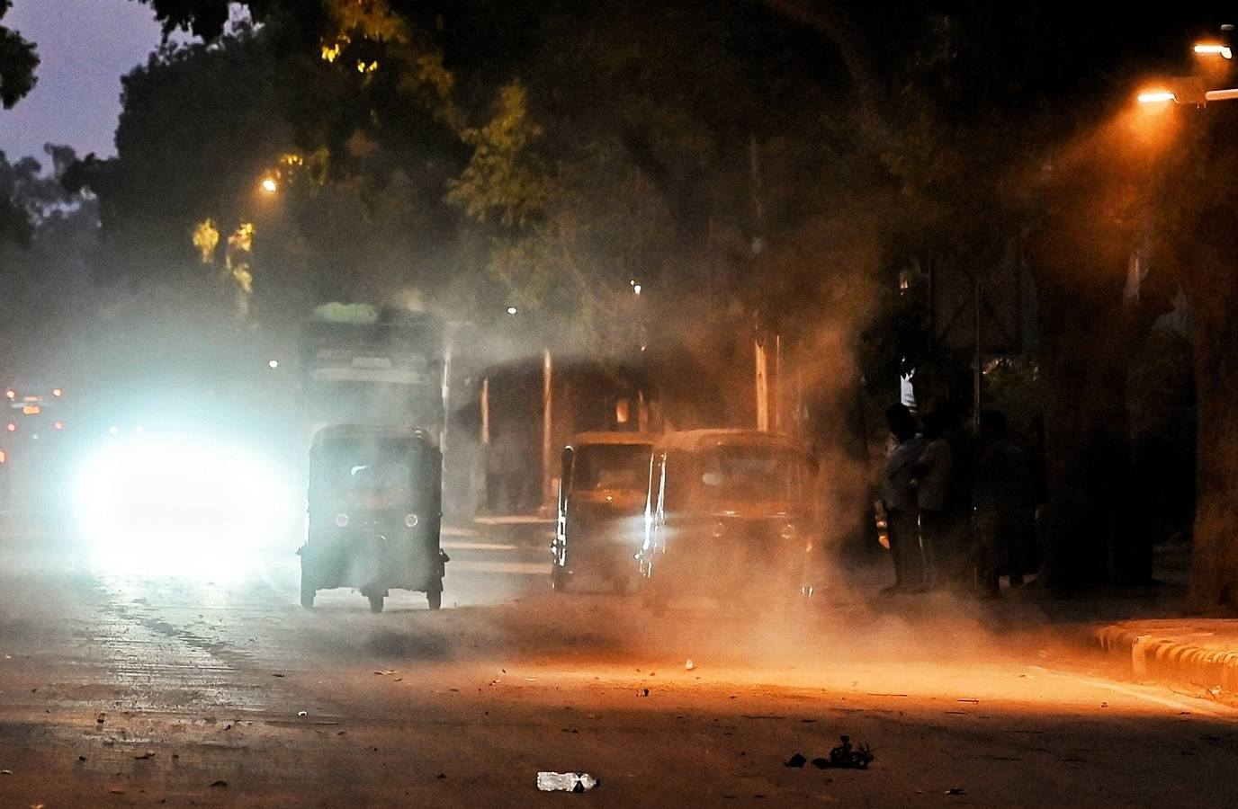
The result was a downdraft: a column of cold, dense air driving toward the surface like a piston falling from altitude. At the surface, the descending column hit the ground and spread outward rapidly in all directions, lifting loose topsoil as it went. The wall of dust was the visible footprint of a downdraft that had evaporated its own rain on the way down.
The rainfall data from overnight makes the mechanism legible. Palam, which recorded the evening's highest wind speed at 120 km/hr, received just 0.1mm of rain across the entire night. In other words, the most violent outflow arrived precisely where almost no rain landed — the storm was strongest where it was driest.